Maps, illustrations and charts in colour drawn by Professor Edward Hull
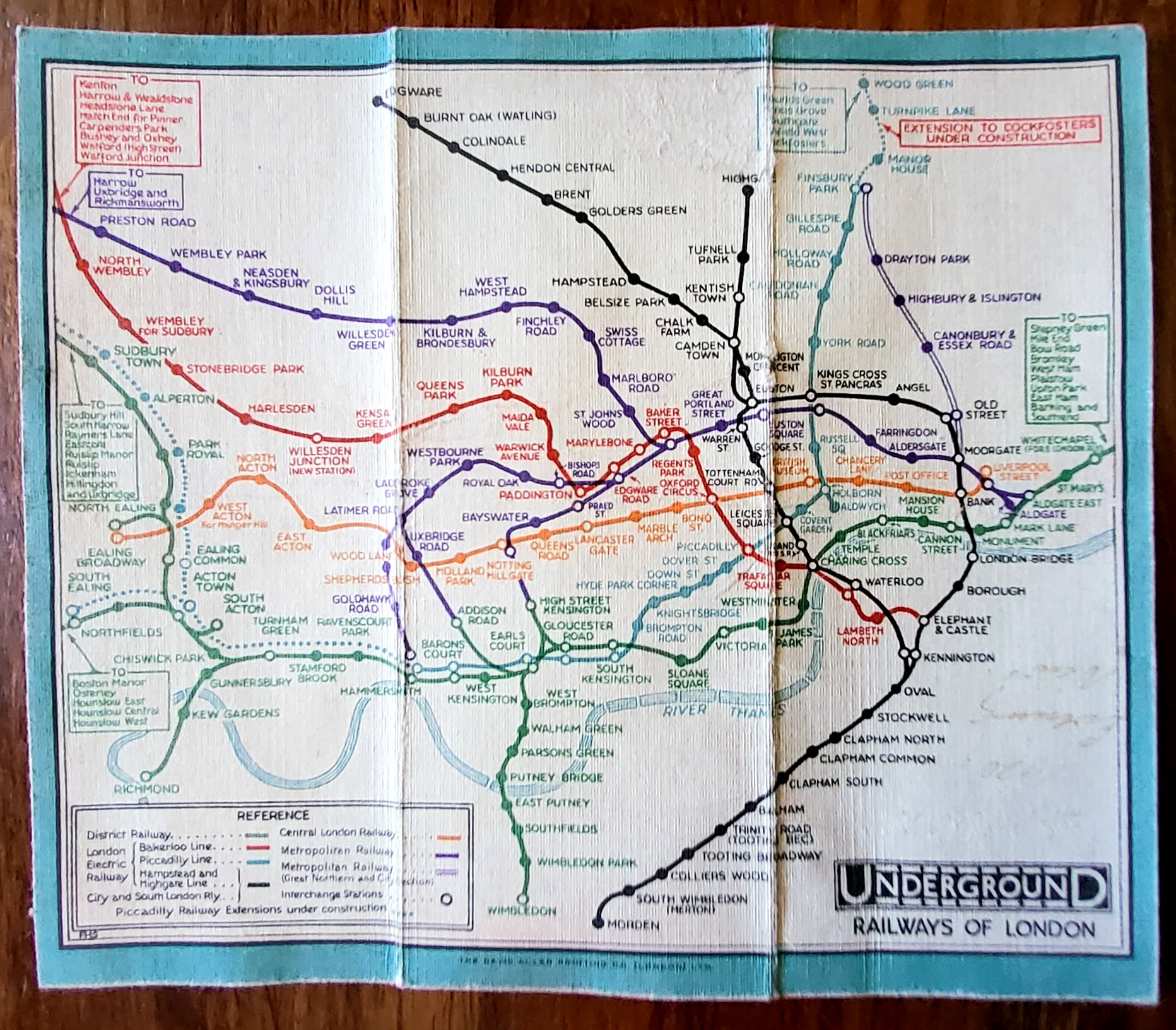
1931 Tube Map
[F. H. STINGEMORE]. Tube Map. London: The David Allen Printing Co (London) Ltd, 1931 £ 250 Dimensions: Folded: 55mm X 142mm Unfolded: 165mm X142mm
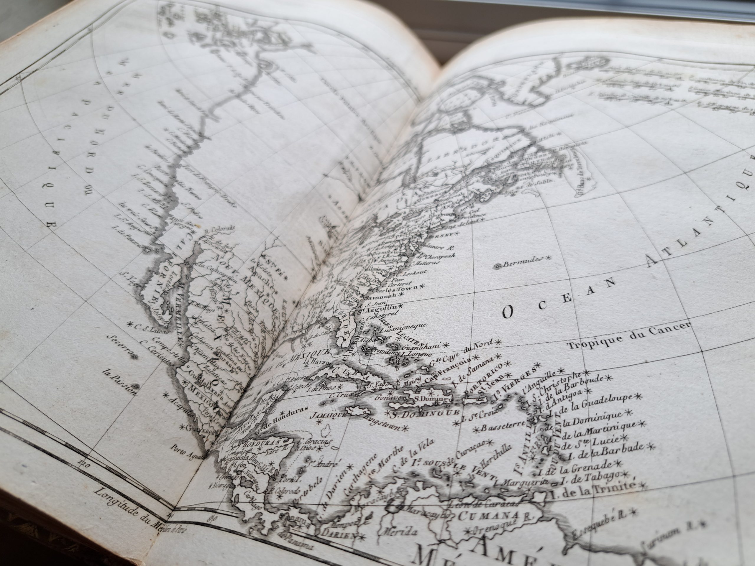
RAYNAL, Guillaume Thomas François. Histoire Philosophique et Politique des Établissements et du Commerce des Européens dans les deux Indes
The expanded Geneva edition of Raynal’s most influential work, a compilation of treatises concerning the commercial dealings of European powers and their colonial domains.
![LAWRENCE, THOMAS EDWARD. [LAWRENCE OF ARABIA]](https://symondsrarebooks.co.uk/wp-content/uploads/2022/04/IMG_8079-scaled.jpg)
LAWRENCE, THOMAS EDWARD. [LAWRENCE OF ARABIA]
ILLUSTRATED COPY
MALTON, James.
A MAGNIFICENT AND RARE COPY
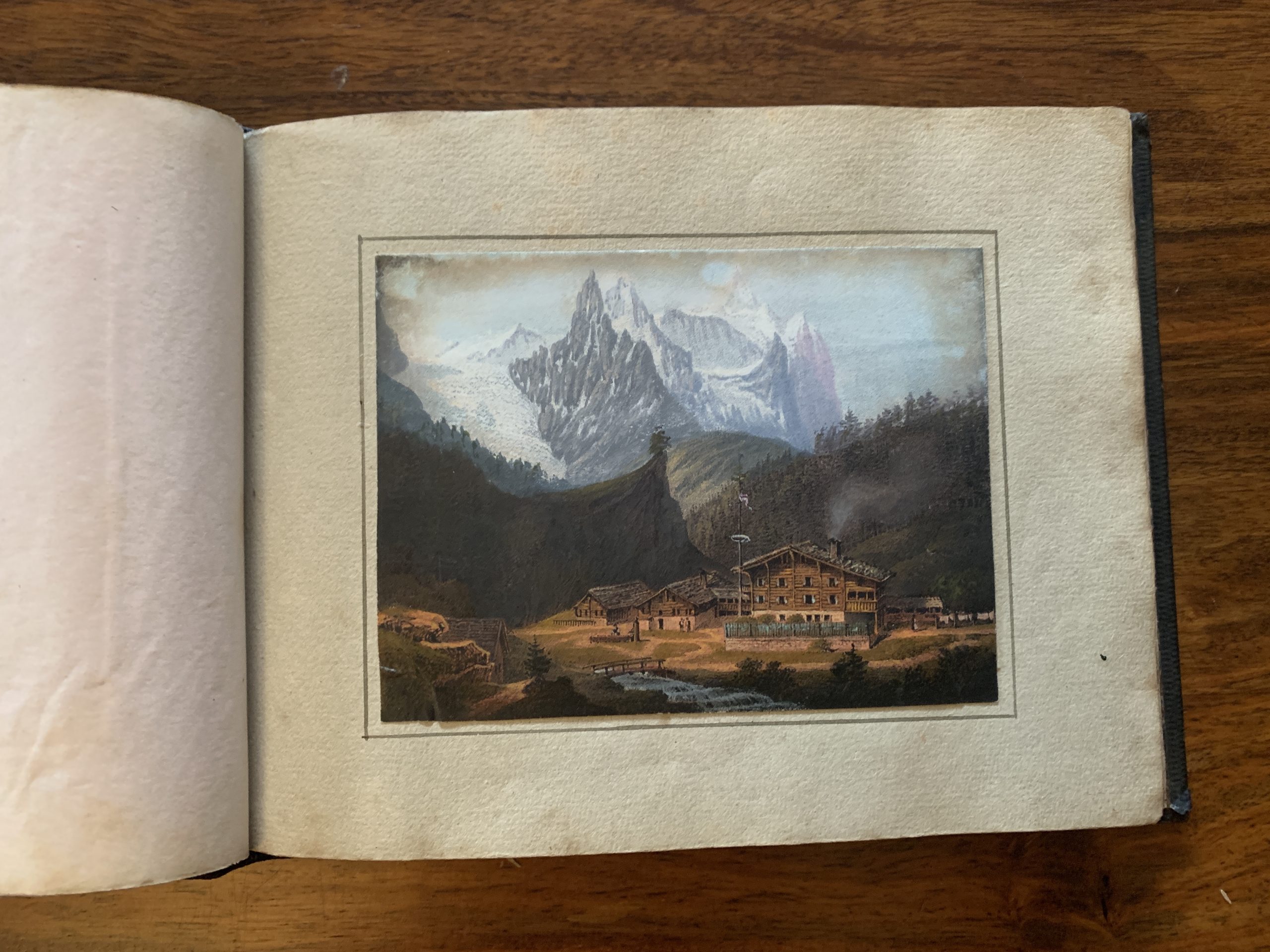
SOUVENIR DE LA SUISSE
A DELIGHTFUL ALBUM
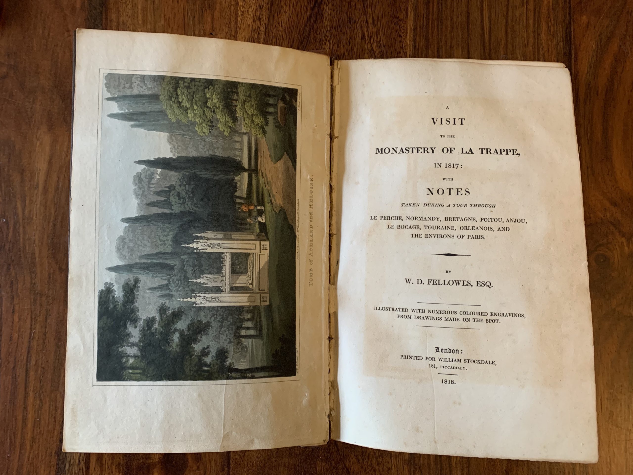
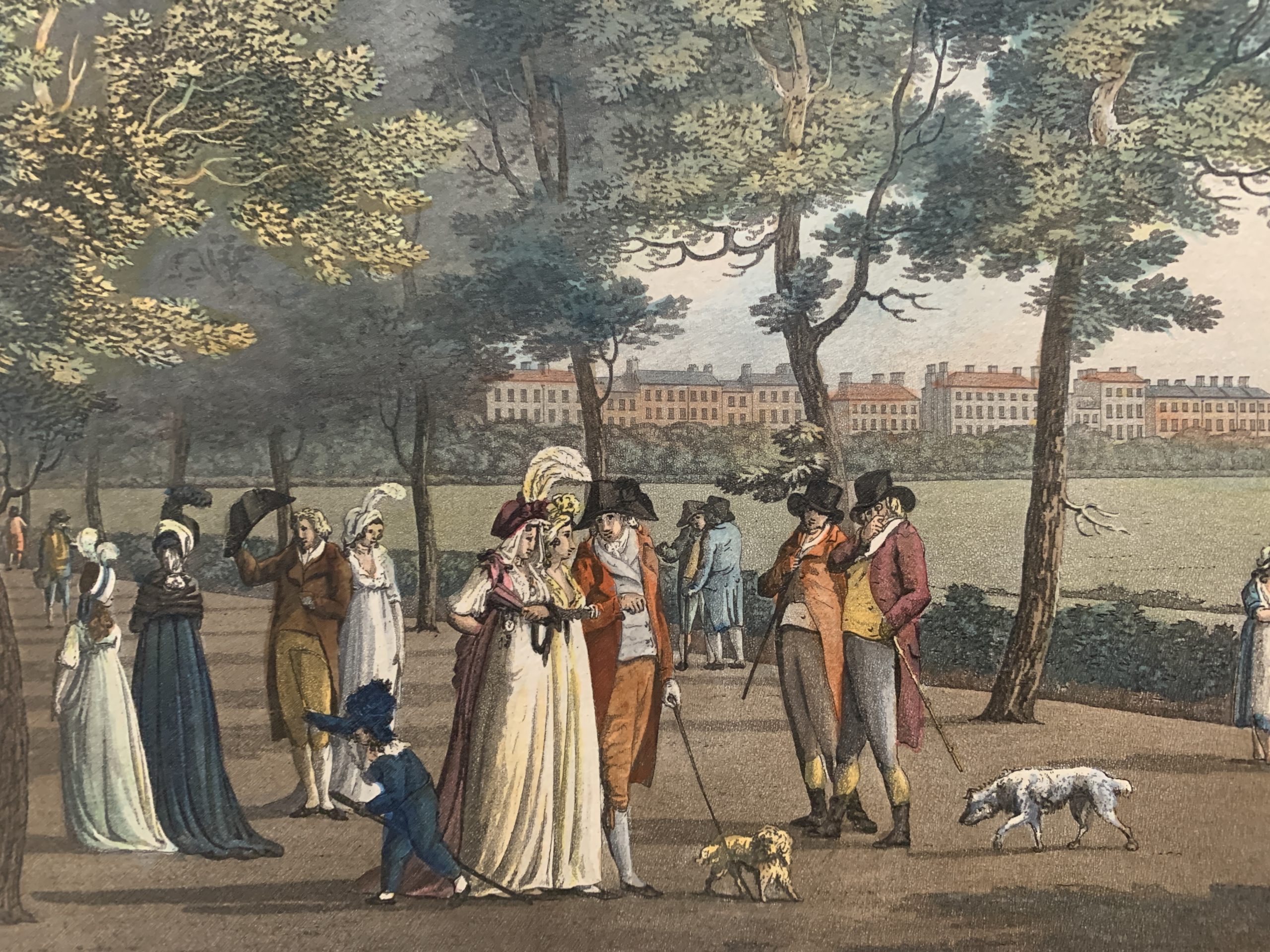
FELLOWES, William Dorset
WITH NUMEROUS COLOUR ENGRAVINGS
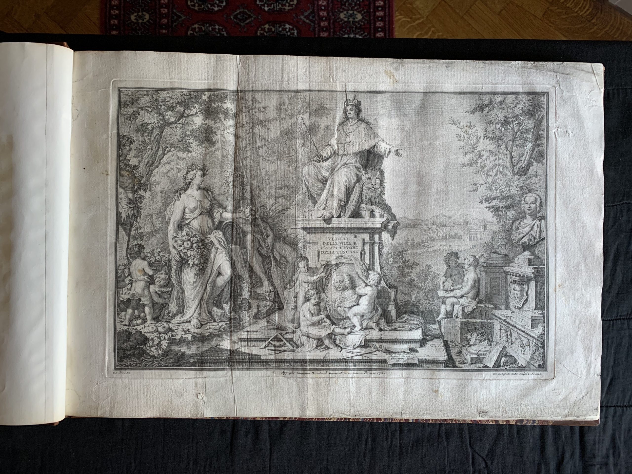
ZOCCHI, Giuseppe
MAGNIFICENT WORK ON THE VILLAS AND COUNTRY HOUSES OF TUSCANY
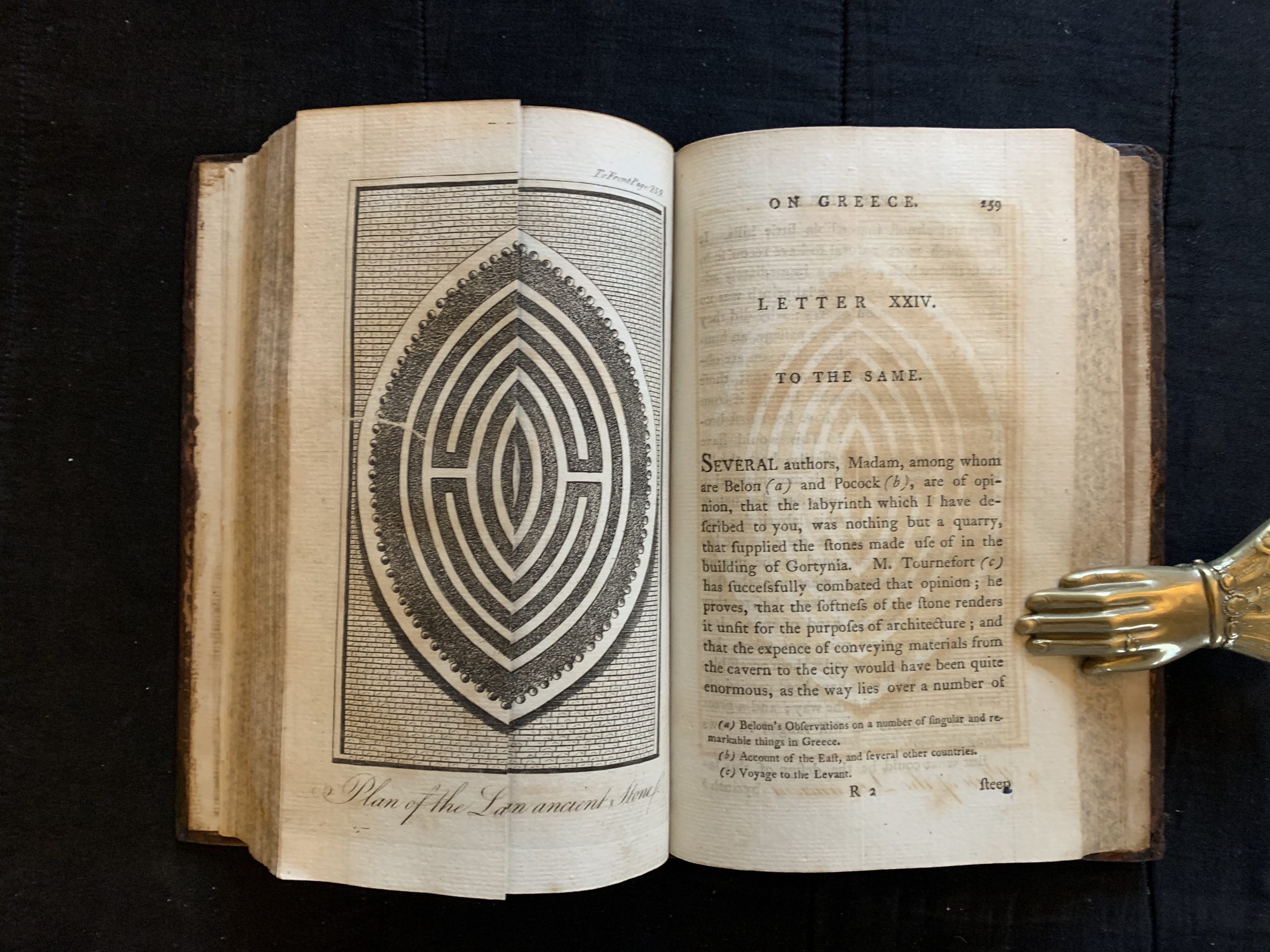
SAVARY, Claude Étienne
AN EPISTOLARY ACCOUNT OF TRAVELS THROUGH THE GREEK ISLANDS
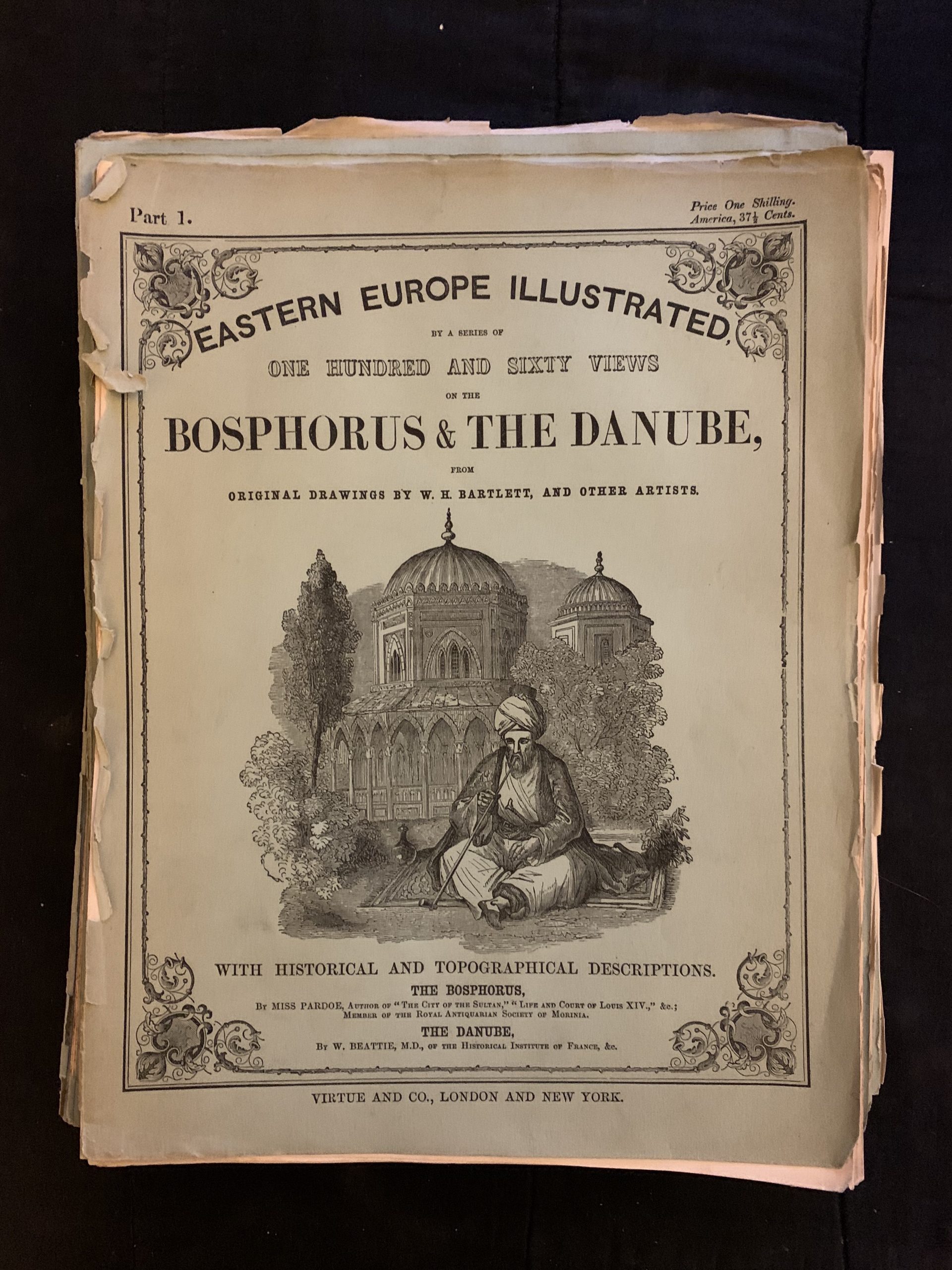
Eastern Europe Illustrated
Eastern Europe Illustrated, A Series of One Hundred and Sixty Views on the Bosphorus & the Danube from Original Drawings by W.H. Bartlett, and other artists. With Historical and Topographical Descriptions. The Bosphorus by Miss Pardoe, […]